Eye in the sky speeds forage research on saline soils
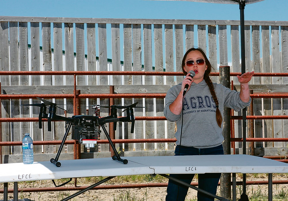
A blustery day grounded Alex Waldner’s planned demonstration flight — an occupational hazard for Saskatchewan drone pilots, she said — but the University of Saskatchewan master’s student waxed enthusiastic about the value of an eye in the sky for research and producers.
By Michael Robin - Western ProducerIf anybody is interested in getting into drones but is maybe feeling hesitant about it, I would suggest just going for it, she said. I had zero experience prior to going into this project and it was actually straightforward to fly the drone and collect the NDVI values.
NDVI, or normalized difference vegetation index, measures the difference between red and near-infrared light.
It measures the amount of greenness, Waldner said.You can use that to look at biomass and yield and vegetative cover etcetera.
She presented a progress report on her work at the Livestock and Forage Centre of Excellence Field Day on June 20. The LFCE is a research unit of the U of S located southeast of Saskatoon.
Working under the supervision of forage crop breeding researcher Bill Biligetu with the Crop Development Centre at the U of S, Waldner is tackling a frequent headache for producers: how to manage Saskatchewan's often saline soils.When the soil is worked to plant annual crops, it dries out and in the process draws salts to the surface. Over time, regular crops cannot grow in the worst patches. Salt-tolerant weeds, such as kochia and foxtail take over, often given an extra boost from previously applied fertilizer that the annual crops could not use. Waldner is looking at one promising approach to the problem: go perennial with salt-tolerant forages whose deep roots draw water and dissolved salts deeper into the soil. She is testing various forage mixtures, for example high salt-tolerant hybrid wheatgrass with barley as a companion crop to help out-compete weeds as the grass takes hold.
We are looking at some of the soil characteristics, so I am measuring soil salinity year to year, she said. So, prior to the forages being established, then one year after the forages are established and seeing if there are differences in salinity between those.
The test fields were seeding in the spring of 2022. Waldner overflew the site in the fall and again in the spring, to measure the overwintering ability of each treatment.
While she said drone operators must get a licence to operate the aircraft, the research flights themselves were a simple matter of using an app to set the corners of the research field to be imaged. The app creates a flight pattern for the drone, which flies the pattern and returns to land when it's done. It's fast, simple and saves research resources.
Waldner cited work by another master's student, David MacTaggart, that compared such aerial data with boots-on-the-ground information collection in his study on cicer milk vetch.
What he found in his research was the drone was successful in identifying high-vigour populations from low vigour populations with very similar accuracy as the ground truth data,she said.
While producers may not need to dig deeply into NDVI data, Waldner said they are adopting drones based on their needs.
I have heard of drones being used for surveying weeds in pasture fields she said. Also, I've heard of thermal sensors that can detect cattle in remote areas. So I think there's getting to be more of that. Maybe not at the same level as researchers but there's definitely potential in the future.
Waldner is also using more traditional research techniques to find out if the strategy improves the quality of the soil. We're also looking at soil health so more specifically microbial biomass to look at whether or not forages can improve soil health in those saline areas as microbes are very sensitive to salinity, she said. So, looking at whether forages can improve that in those soils.
